Bladerikwr (talk | contribs) (Updated imagemap coordinates for new map; credit to User:Nextra123) |
Bladerikwr (talk | contribs) (Fixed Origin region polymap) |
||
| Line 9: | Line 9: | ||
poly 125 1550 385 1550 512 1331 385 1110 125 1110 1 1331 [[Oarbreaker Isles]] |
poly 125 1550 385 1550 512 1331 385 1110 125 1110 1 1331 [[Oarbreaker Isles]] |
||
poly 125 1993 385 1993 512 1774 385 1553 125 1553 1 1774 [[Fisherman's Row]] |
poly 125 1993 385 1993 512 1774 385 1553 125 1553 1 1774 [[Fisherman's Row]] |
||
| − | poly 125 2439 385 |
+ | poly 125 2439 385 2439 512 2216 385 1994 125 1994 1 2216 [[Origin]] |
poly 511 887 770 887 896 668 768 447 510 447 385 668 [[Callum's Cape]] |
poly 511 887 770 887 896 668 768 447 510 447 385 668 [[Callum's Cape]] |
||
poly 511 1328 770 1328 896 1109 768 888 510 888 385 1109 [[Stonecradle]] |
poly 511 1328 770 1328 896 1109 768 888 510 888 385 1109 [[Stonecradle]] |
||
Revision as of 23:58, 3 November 2021
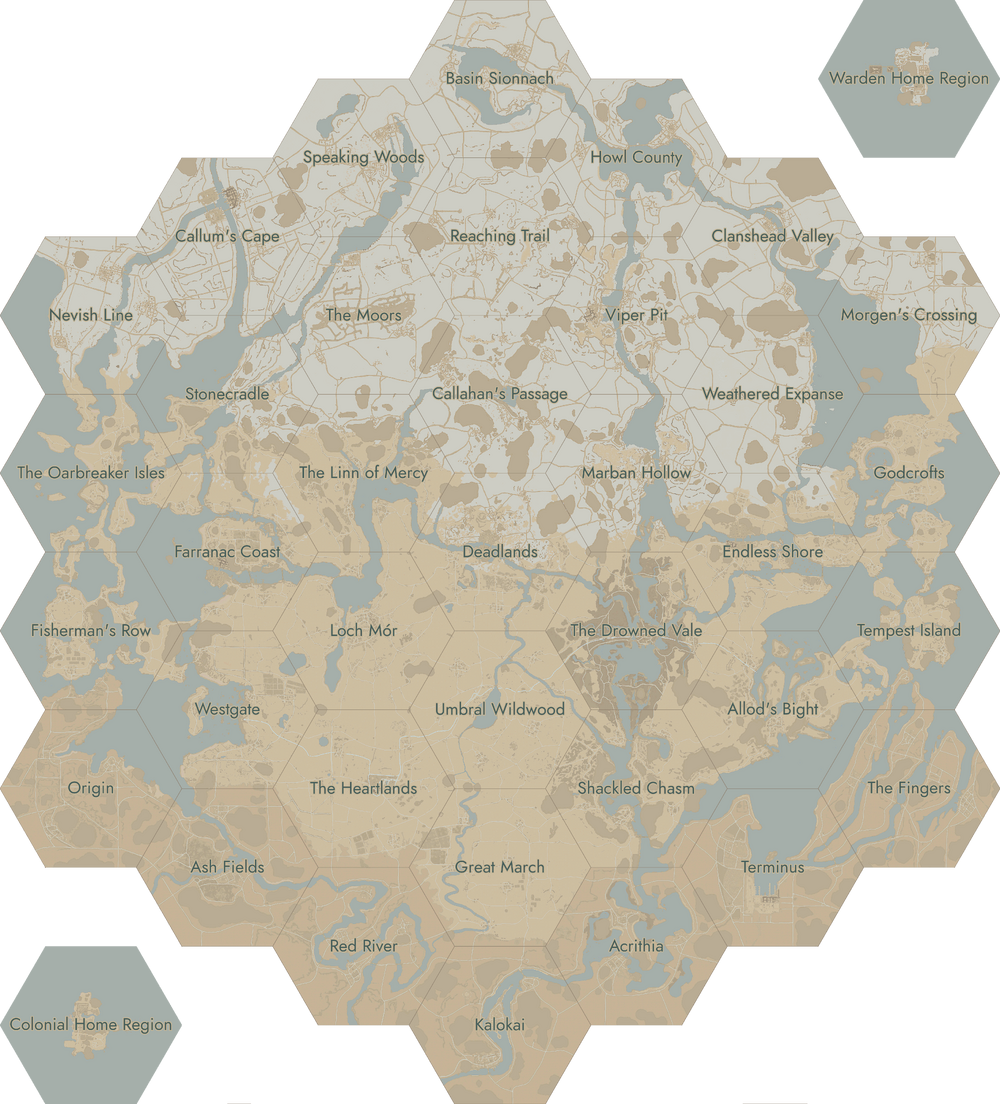
World Map
Click on a region to open its corresponding page.